Animierte Wetterradarkarte: Sturm bei Brescia
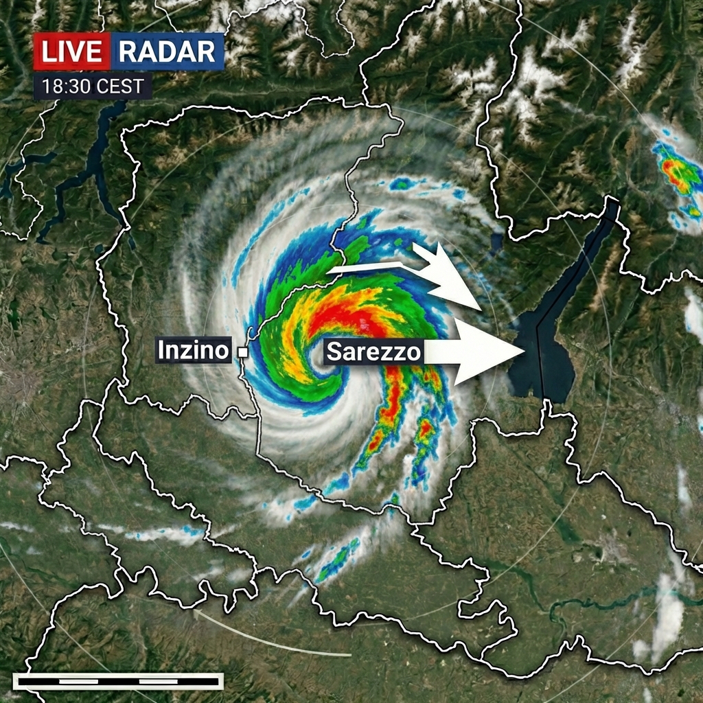
Eine animierte Wetterradarkarte zeigt einen hurikanartigen Sturm ueber der Provinz Brescia in Norditalien. Die Karte hebt Inzino im Westen und Sarezzo im Osten hervor und stellt die ostwaerts gerichtete Bewegung mit realistischen Radar- und Satellitenstrukturen dar. Die Darstellung wirkt wie eine professionelle TV-Wettergrafik mit glatten Animationsuebergaengen.
4 days ago19. Juni 2026 um 23:14
Deutsche Lesefassung
Diese Uebersetzung dient nur dem Verstaendnis. Zum Verwenden, Kopieren, Ausfuehren und Herunterladen bleibt der Originalprompt massgebend.
Eine animierte Wetterradarkarte zeigt einen Sturm ueber Brescia in Norditalien mit markierten Orten Inzino und Sarezzo sowie einer ostwaerts gerichteten Bewegung und realistischen Radar- und Satellitenstrukturen.
Originalprompt verwenden